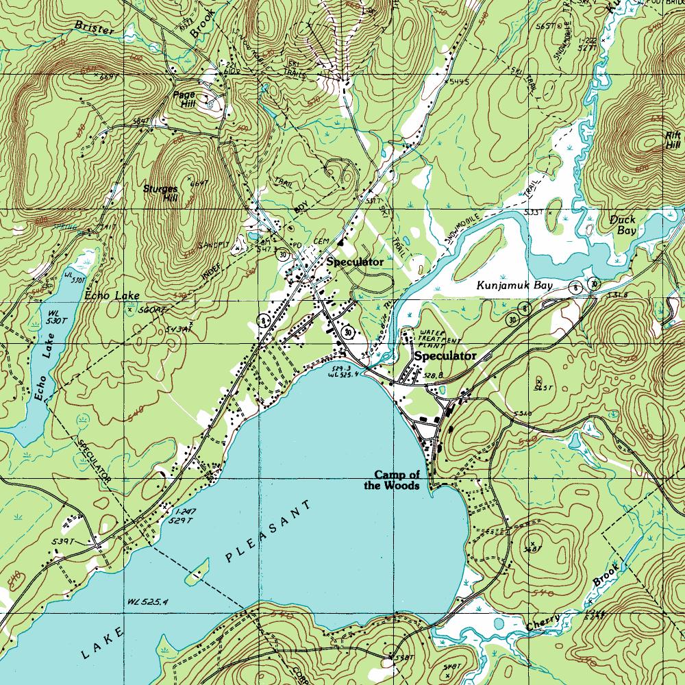
Topographic maps are designed to depict an areas topography (imagine that!) Topographic maps include details for any feature that could be found in an areas topography. In the example image, it is clear there is a lake with an island, a small river, some steep mountainous regions and also a bay. Contour lines are included to denote elevation (see more on Countour Maps).
Tuesday, April 9, 2013
Stem and Leaf Plot
Stem and Leaf plots are a quick and efficient method of organizing data into groups, and then quickly assessing which group as the most data. In the example above, the data is simply numbers, and the groups are dictated by the number in the tens place. It is easy to see without the highlight that the 4 group has the most numbers.
Propaganda Map
Propaganda maps are made to accompany propaganda and persuade individuals towards a certain opinion. Data is skewed intentionally to make a certain option seem more appealing. In the propaganda map depicted, Ronald Reagan sees the USSR as a looming threat, while South America and and Mexico are barely worth showing. Propaganda maps play off ignorance of an individual and claim to educate, except the education received is full of bias and half-truths.
Cartogram
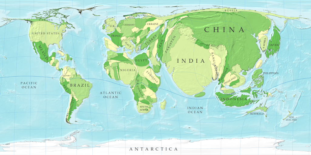
Cartograms are maps that are distorted to show different variables, replacing distance or land area with a theme such as population or national interest. Above is a cartogram showing population of continents and their respective nations. Places such as India, China, and the United States are quickly seen to be places of overcrowding, while areas like Canada and Australia are extremely underpopulated for their nation size. Cartograms are best used as models to compare issues between states, and are not designed to accurately depict land forms.
Contour Map
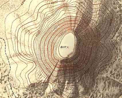
A contour map shows elevation with lines that represent levels of equal height. The picture above is a well defined and depicted contour map showing a plateau. Typically a contour map has a darker or bolder line every 5 or 10 lines. In this map the bolded line is present every 5th line which also denotes 100 units of measurement.Locations that show lines more closely spaced together represent areas with a steep incline. Contour lines farther apart show more gentle slopes.
LIDAR-Light Detection and Ranging
LIDAR is a remote sensing technique that fires laser light at an object and collects data based on the objects resulting illumination. Laser instruments are attached to aircraft and data is collected as the aircraft passes over an object. High resolution beams can produce very precise images, but have a narrower beam size and therefore take longer to produce a complete image. The image above is a LIDAR image of the world trade center on September 23rd, 2001.
DEM-Digital Elevation Model; Hillshade
http://developmentseed.org/blog/2009/jul/30/using-open-source-tools-make-elevation-maps-afghanistan-and-pakistan/
Depicted above is a Digital Elevation Model of some mountains and the surrounding country. DEM's are useful in showing vertical data in several ways. Above is a hillshade, a rendering of elevation data to show shadows and depressions, and a color relief map to more easily contrast land features like mountains. Numerical data is often difficult to understand, and before computer technology it was only more so. With satellite imagery and hillshade models it has become infinitely more easy to represent elevation data in a visual manner.
Here are the two separate images of the elevation rendering(top) and the color relief map(bottom), combined to create a hillshade
Subscribe to:
Posts (Atom)